
SAMPLING AND FIELD MEASUREMENTS
The Laboratory for Sediment and Soil Analysis (SEDILAB) ensures the sampling and field meausurements for the physical geographical researches. These measurements are the following:
Geodetic measurements
Task related to localization and digital terrain modelling
GPS: Thales mobilemapper; Magellan mobilemapper cx
1 meter precision with real time measurements, 30 cm precision with post-processing; Point, line and area measurement; Object library management; Eccentric measurement; Raster and vector maps; Object repetition; Grid data collection; Raw measurement data collection
Global Total Station: Trimble 3300DR
Angular deviation: 5”Telemetry deviation: +/-(2mm+2ppm)/km
Be able to do reflectorless measurement where the reflection is done directly from the measurable surface
Range:
with reflector: 3000m;
to film, plastic reflector: 800m;
without reflector: 100m
Internal memory: 1900 points
The internal battery provides 5 hours of continuous work (NiMh 1,6Ah).
Built-in programs: Assessment orientation, area calculations, elevation transmission, polar coordinate measuring, eccentric objects measurement, elevation resection Accessories: Data transfer cable and software, instrumentation foot, reflector, reflector pole, meter-long boxes, instruction manual, battery charger.
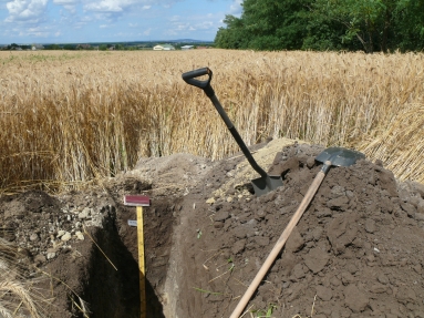
Soil sampling
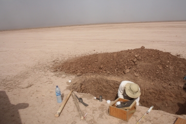
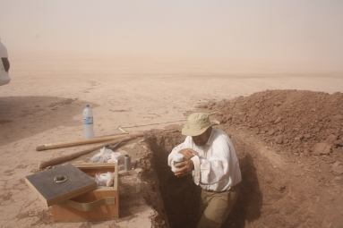
Sampling by excavation
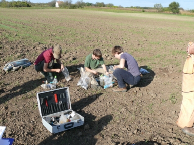
Pedon excavation according to Szabolcs I. (1966) and USDA (2004).
Sampling according to specific needs: by genetical and diagnostical zones, from boundary of horizones and from specific depth from the surface.
Sampling by hand auger
With Eijkelkamp hand auger
Maximal depth of the sampling: 6 m
Available auger types: Edelman (for different textural soils), Riverside, Spiral
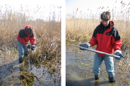
Sampling from below the soil water level and from flooded area: Piston sampler
Undisturbed sampling
With edge drawn steel tubes with a volume of 100 cm3 (Vér-type tubes)
Applied methods for soil sampling
- Szabolcs István (szerk) Genetikus üzemi talajtérképezés kézikönyve. Országos Mezőgazdasági Minőségvizsgáló Intézet, 1966.
- USDA – Soil Survey Laboratory Methods Manual v 4.0 (2004)
- MSz-08-0202:1977 Helyszíni mintavétel mezőgazdasági célú talajvizsgálatokhoz (2015.06.01-től visszavonva)
- MSZ 21470-1:1988 Környezetvédelmi talajvizsgálatok. Mikrobiológiai vizsgálatok
Soil moisture measurement
Laboratory soil moisture measurements from undisturbed samples
by laboratory gravimetric measurements: these measurements are recommended in addition to the instrumental soil moisture measurements, because those measurements give soil moisture content in volume%. Therefore the similar %(v/v) values in soils with different porosity indicate significantly different water content.
Soil moisture measurement with portable TDR (AquaterraLab) equipment Soil moisture monitoring measurement in installed Tecanat® tubes. The moisture content of the soils can be measured until 80 cm depth. The soil moisture measurement allows high spatial density monitoring analysis.
Soil moisture measurement by electrical conductivity (gypsum blocks)
Soil moisture monitoring measurement by installed data logger. 10-10 gypsum blocks can be connected as data loggers. With this method even one minute frequency measurement is possible.
Eh, pH, EC, and dissolved oxigen measurments in surface water, groundwater and soil
Here, similar to the soil moisture masurements, pH, redox conditions, electrical conductivity, and dissolved oxygen monitoring measurements are possible in hydromorphic soils, groundwaters and surface waters. With installed data loggers even one minute resolution measurements are possible.